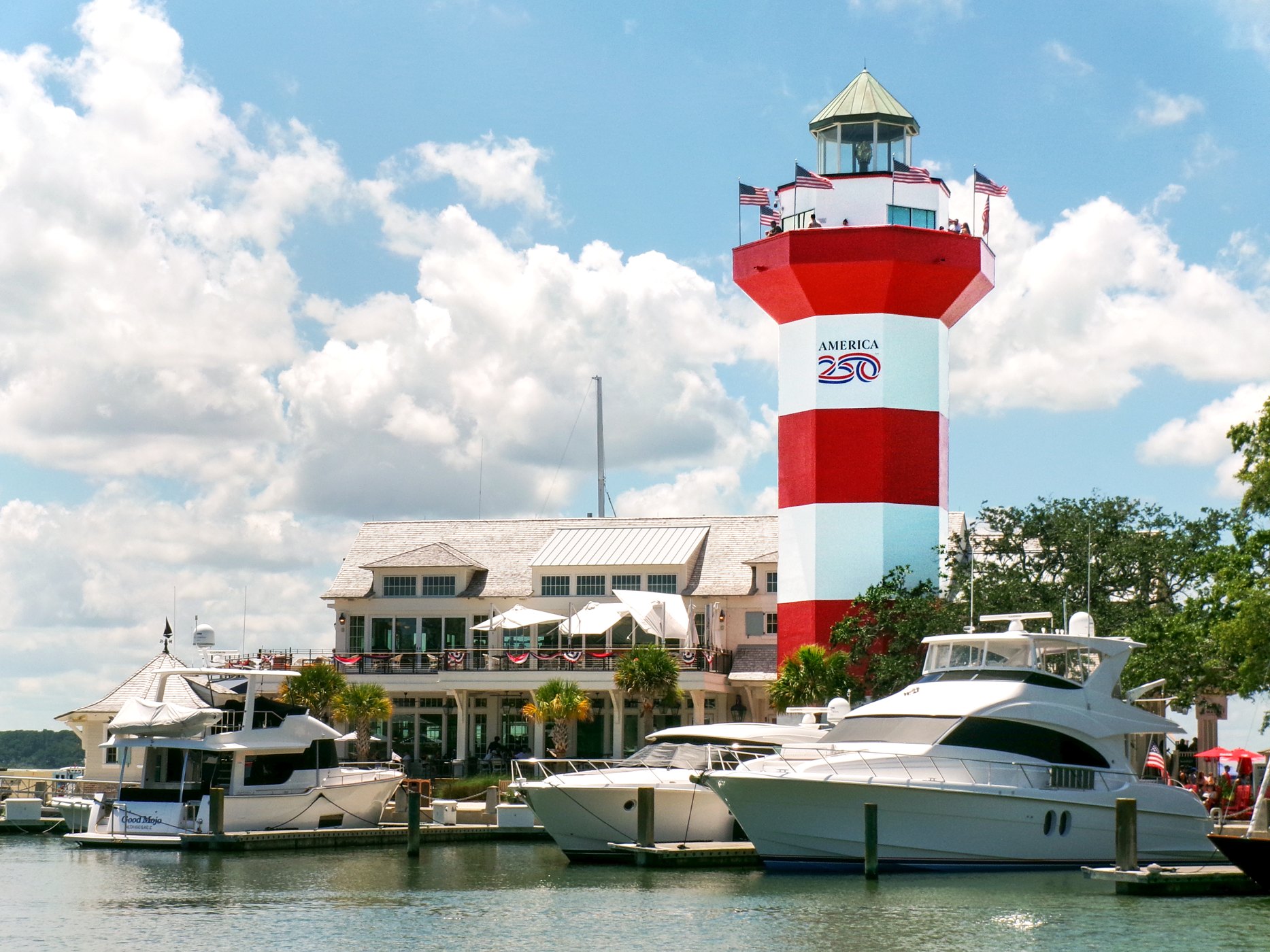
Harbour Town lighthouse in Sea Pines

Outdoors

Swimming holes and lakes near Hilton Head Island

Lakes, rivers and beaches near Hilton Head Island where swimming is allowed on public land.

11places to swim
39 mito the closest
April–Octoberbest months

Good to know: Most natural swimming areas have no lifeguard; check water-quality advisories and current conditions before swimming.

Closest picks

1

ACE Basin National Estuarine Research Reserve

39 mi northeast · National Oceanic and Atmospheric Administration

ACE Basin is one of the largest undeveloped estuaries on the East Coast. It's named for the Ashepoo, Combahee and Edisto rivers, which meander past cypress swamps, historic plantation homes, old rice fields and abundant tidal marshes to…
2

Sapelo Island National Estuarine Research Reserve

61 mi southwest · National Oceanic and Atmospheric Administration

Located midway on the Georgia coastline on the eastern fringe of McIntosh County, Sapelo Island is defined by the Sapelo River to the north, the waters of Doboy Sound to the south, the Atlantic Ocean to the east, and the Duplin River to…

3

Gullah/Geechee Cultural Heritage Corridor

71 mi northeast · National Park Service

Designated by Congress in 2006, the Gullah Geechee Cultural Heritage Corridor extends from Wilmington, North Carolina in the north to Jacksonville, Florida in the south.

Map of all 11 places

Map of 11 places loads as you scroll.

30 to 75 miles (3)

39 mi northeast · National Oceanic and Atmospheric Administration

ACE Basin National Estuarine Research Reserve

ACE Basin is one of the largest undeveloped estuaries on the East Coast. It's named for the Ashepoo, Combahee and Edisto rivers, which meander past cypress swamps, historic plantation homes, old rice fields and abundant tidal marshes to…

  • Paddling
  • Photography
  • Ranger programs
  • Swimming
  • Wildlife viewing

61 mi southwest · National Oceanic and Atmospheric Administration

Sapelo Island National Estuarine Research Reserve

Located midway on the Georgia coastline on the eastern fringe of McIntosh County, Sapelo Island is defined by the Sapelo River to the north, the waters of Doboy Sound to the south, the Atlantic Ocean to the east, and the Duplin River to…

  • Hiking
  • History
  • Paddling
  • Photography
  • Ranger programs
  • Swimming
  • Wildlife viewing

71 mi northeast · National Park Service

Gullah/Geechee Cultural Heritage Corridor

Designated by Congress in 2006, the Gullah Geechee Cultural Heritage Corridor extends from Wilmington, North Carolina in the north to Jacksonville, Florida in the south.

  • Biking
  • Fishing
  • History
  • Paddling
  • Picnicking
  • Swimming
  • Wildlife viewing

75 miles and farther (8)

100 mi southwest · National Park Service

Cumberland Island National Seashore

St Marys is the gateway to Cumberland Island, Georgia's largest and southernmost barrier island. Here pristine maritime forests, undeveloped beaches and wide marshes whisper the stories of both man and nature.

  • Biking
  • Boating
  • Camping
  • Hiking
  • Hunting
  • Swimming
  • Wildlife viewing

111 mi southwest · National Park Service · Campground

Cumberland Island National Seashore Camping Permits

Whether you are looking to spend a night with family and friends around a campfire under the moss covered branches of the live oak trees, or looking for the rugged challenges and solitude of the wilderness, you will find it on Cumberland…

  • Backpacking
  • Beach
  • Birding
  • Boating
  • Camping
  • Fishing
  • Hiking
  • Kayaking

115 mi northwest · National Park Service

South Carolina National Heritage Corridor

Designated in 1996, the South Carolina National Heritage Corridor is committed to promoting and preserving the cultural, natural and historic resources of the state.

  • Biking
  • Camping
  • Fishing
  • Hiking
  • Paddling
  • Swimming
  • Wildlife viewing

121 mi northeast · National Oceanic and Atmospheric Administration

North Inlet-Winyah Bay National Estuarine Research Reserve

North Inlet-Winyah Bay National Estuarine Research Reserve protects more than 12,327 acres of habitats ranging from tidal and transitional marshes to oyster reefs, beaches, and inter-tidal flats and from coastal island forests to open…

  • Paddling
  • Photography
  • Ranger programs
  • Swimming
  • Wildlife viewing

132 mi northwest · US Army Corps of Engineers · Campground

Clarks Hill

Clarks Hill is a popular park on J. Strom Thurmond Lake, just off Georgia State Highway 221 near the dam.

  • Boating
  • Camping
  • Fishing
  • Picnicking
  • Swimming
  • Water Access

132 mi northwest · US Army Corps of Engineers · Campground

West Dam

West Dam Recreation Area is one of the most popular parks on J. Strom Thurmond Lake. With 70,000 acres of surface-area and 1,000+ miles of shoreline, J.

  • Camping
  • Fishing
  • Hiking
  • Picnicking
  • Swimming

134 mi northwest · US Army Corps of Engineers · Campground

Lake Springs

Lake Springs Recreation Area is one of the most popular parks on J. Strom Thurmond Lake. The park is located on Georgia State Highway 221 within twenty minutes of Augusta, Georgia.

  • Accessible Swimming
  • Biking
  • Boating
  • Camping
  • Fishing
  • Hiking
  • Lookout Tower
  • Picnicking

135 mi northwest · US Army Corps of Engineers · Campground

Petersburg

Petersburg Campground is located on J. Strom Thurmond Lake, only four miles away from the Lake Thurmond Visitor Center and Dam and only 25 miles from Augusta, Georgia.

  • Biking
  • Birding
  • Boating
  • Camping
  • Fishing
  • Hiking
  • Kayaking
  • Photography

Distances are straight-line miles from downtown Hilton Head Island. Listings come from Recreation.gov’s federal recreation database; check each official page for hours, fees, fire restrictions and closures before you go.

Get outside around Hilton Head Island

Top 10 Things To Do In Hilton Head Island South Carolina USA video thumbnail

THINGS TO DO · YOUTUBE SHORT

Top 10 Things To Do In Hilton Head Island South Carolina USA

A local activity Short shared by g-trav.

Watch on YouTube ↗

Around Hilton Head Island

Cherry Hill School, Hilton Head Island
Cherry Hill SchoolCynthia Jennings · CC BY-SA 4.0
Holy Family Church - Hilton Head, Hilton Head Island
Holy Family Church - Hilton Head 01Farragutful · CC BY-SA 4.0
Disney HHI Resort, Hilton Head Island
Disney HHI Resort July 2007 01MoodyGroove at en.wikipedia · CC BY-SA 3.0

More outdoors near Hilton Head Island

Questions

Where is the closest place for swimming near Hilton Head Island?

ACE Basin National Estuarine Research Reserve (National Oceanic and Atmospheric Administration), about 39 miles northeast of Hilton Head Island as the crow flies. Next are Sapelo Island National Estuarine Research Reserve (61 mi) and Gullah/Geechee Cultural Heritage Corridor (71 mi).

When is the best time for swimming near Hilton Head Island?

Based on Hilton Head Island’s average highs, April–October. Conditions at higher elevations can be much cooler.

Who manages these places?

Federal agencies including National Park Service, US Army Corps of Engineers, National Oceanic and Atmospheric Administration. Each listing links to its official page for hours, fees, closures and current conditions.

Hilton Head Island AI

Your Hilton Head Island local guide
Hey there!

I'm Hilton Head Island AI. Ask about neighborhood food, independent shops, local history or planning a visit.

AI recommendations may be inaccurate. Verify hours and prices. Questions are processed by Cloudflare. Privacy